Borings Begin in Downtown Nashville
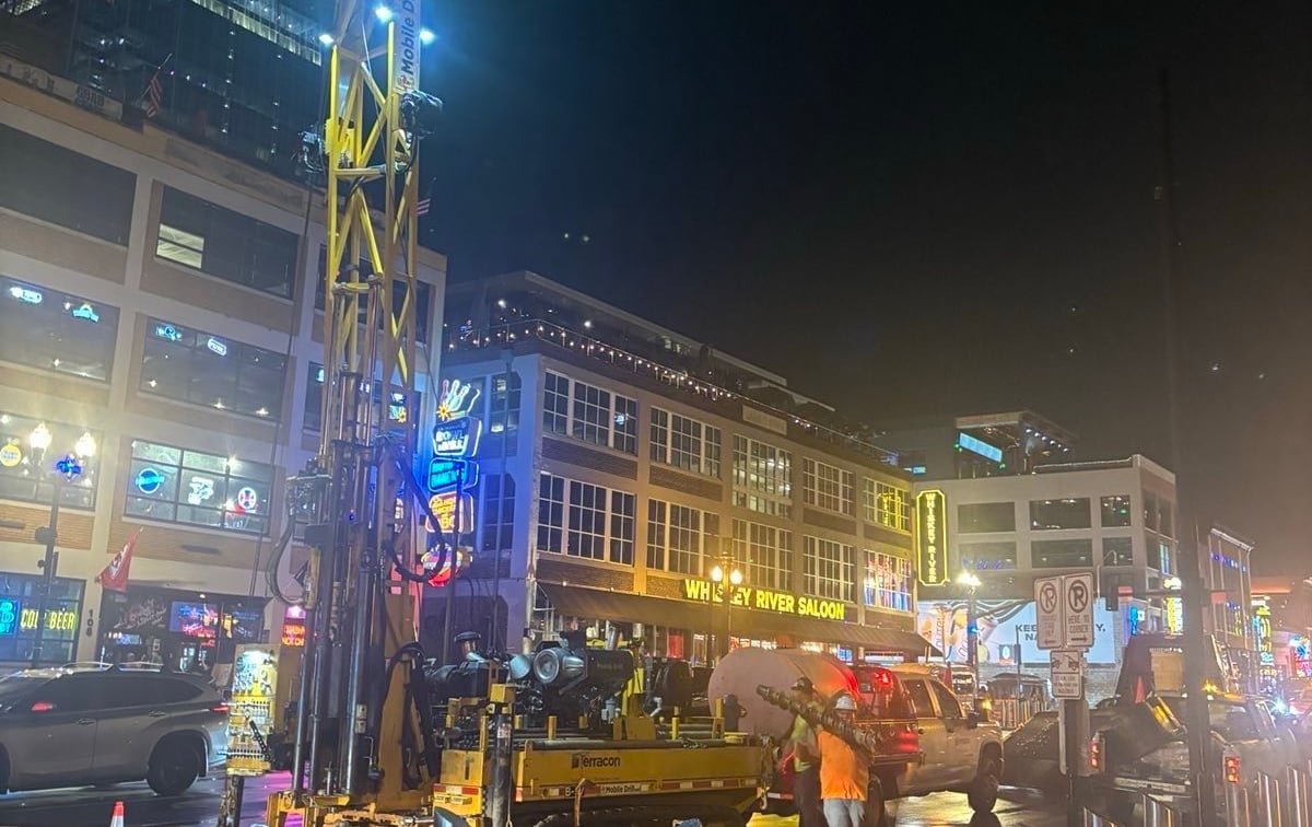
The Boring Company began geotechnical exploratory drilling at First & Broadway and Fourth & Broadway. The work is intended to collect information about soil, rock, groundwater and utilities beneath the corridor.
Geotechnical borings are an early engineering step. They can help evaluate construction feasibility and design options, but they do not constitute approval of a tunnel alignment or station.
Why Broadway Matters
Broadway is a state-owned roadway, so work beneath it would involve state right-of-way decisions. Other elements of a possible downtown route could also require coordination with Metro departments, utilities, property owners and emergency services.
The drilling locations are outside the originally announced airport-to-Capitol corridor. That makes them relevant to questions about possible expansion, while leaving the route and station plan unconfirmed.
What Remains Unknown
The company and the state had not announced a final Broadway alignment, station locations, construction budget or schedule at the time of publication.
Any expansion would require engineering plans, property agreements, permits and review of construction, utility, safety and environmental issues.
What to Watch
Future permit filings, signed agreements and formal route maps will show whether the exploratory work develops into a proposed expansion. Until then, the drilling should be understood as data collection rather than a construction commitment.
Update: Exploratory work became part of a larger corridor
Later project materials described a Broadway–West End alignment in addition to the airport corridor. That development makes the October 2025 drilling an early data-gathering step in a corridor that subsequently became more specific, but it does not mean every location tested will contain a tunnel, station or surface facility.
In February 2026, Tennessee announced state and federal approval of a lease application and enhanced grading permit for use of state property and right-of-way. Those approvals were a more consequential milestone than the exploratory borings because they addressed actual construction authority on the property covered by the documents.
How readers can verify the next steps
A geotechnical program produces inputs for engineers: core samples, groundwater observations and records of subsurface conditions. A buildable design requires those findings to be combined with utility surveys, structural calculations, property rights and permit conditions. Public route maps are useful summaries, but filed plans and executed agreements provide stronger evidence of exactly what has been authorized.
For Broadway, the most informative future records will identify station parcels, entrance locations, construction staging areas and responsibility for surface restoration. They should also show how the project will protect utilities, maintain access for businesses and coordinate emergency response in Nashville’s busiest entertainment district.
Why exploratory drilling can cover more than one option
Engineers often test several possible paths before selecting a final alignment. Some boring locations may rule out an option, identify a need for mitigation or support an alternative that is never built. The value of the work is the subsurface evidence it produces, not a guarantee that construction will follow every test location.
For readers tracking the project, dates and addresses matter. Comparing drilling notices with later plans can show which options advanced and which disappeared. It can also help distinguish temporary lane or sidewalk work from the much larger effects of a station excavation or launch site.
The archived Oct. 10 follow-up covered substantially the same exploratory work and has been removed from search indexing to avoid presenting overlapping reports as separate developments. Its useful premise—testing does not equal route approval—is retained and developed more fully here.
Future coverage will link those records to the specific parcel or corridor they govern. That makes it possible to distinguish evidence about one authorized location from broader claims about the entire proposed network.
SOURCES
- Music City Loop project information and updates · The Boring Company
- State and federal approvals announced for Music City Loop right-of-way · Office of Tennessee Gov. Bill Lee